
Follow a Grove City Street Record
A street-by-street search works best as a chain, not as a household list. The Franklin County Auditor connects a site address to a parcel and its owner of record. The Parcel Viewer places that parcel on a block. The Recorder then supplies the instruments affecting that land. A voter lookup may confirm a specified person as a registered voter where the law permits, but it is not a way to browse everyone on a street. Historical directories and census work add dated occupancy only after the address has been tied to the right parcel.
Use each step to answer a narrower question. The resulting property trail may identify property interests, tax-record contacts, dated occupants, or nearby parcel boundaries. It cannot turn one address into a complete list of household members. Keep the site address, owner mailing/contact field, parcel number, legal description, and transfer date separate in notes so the next record can be checked against the same property.
- Search the address in the Franklin County Auditor Property Search and save the parcel ID, legal description, and latest transfer details.
- Open the same parcel in the Auditor Parcel Viewer to inspect its mapped position and the adjoining parcel geometry.
- Search the current owner or a known party in the Recorder index, using the legal description or subdivision where an older document lacks a familiar street number.
- For a specific voter question, use Ohio My Voter Information with first name, last name, and Franklin County. Treat a result as registration information, not proof of every resident.
- For an earlier household, compare an actual historical directory volume and census year after confirming the address trail. The historical collections themselves are available through the Grove City city directories.
Search Grove City Streets Without a Suffix
The Auditor address form is built for a practical Grove City address search. It splits the query into street number, direction, street name only, and unit. Do not type the suffix such as Road or Avenue in the street-name field. For a broad street result, the official instructions show a wildcard before the name, such as *High; a directional version such as S *High narrows that pattern. Add a number or direction when the result set is too large. The form also offers result sorting and results-per-page controls.
| Auditor control | How it works | Street-directory use |
|---|---|---|
| Street No | Optional address field | Limits a street result to one numbered location. |
| Direction | Optional dropdown | Separates directional segments when they exist. |
| Street Name Only | Text, no suffix | Use the bare name or a wildcard to list matching parcels. |
| Unit | Optional text field | Qualifies an address when a unit is known. |
| Map or Intersection Search | Separate spatial modes | Helps when a full postal address is not available. |
Incomplete or unmatched address, owner, and parcel queries can return up to 500 results. That cap is a reason to refine the search, not a claim that a street has fewer parcels. The Auditor also reported system maintenance during research, so important entries should be verified with its Real Estate Division at 614-525-4663 or appraisal@franklincountyohio.gov.
See the official Auditor address search before entering a street-only query.
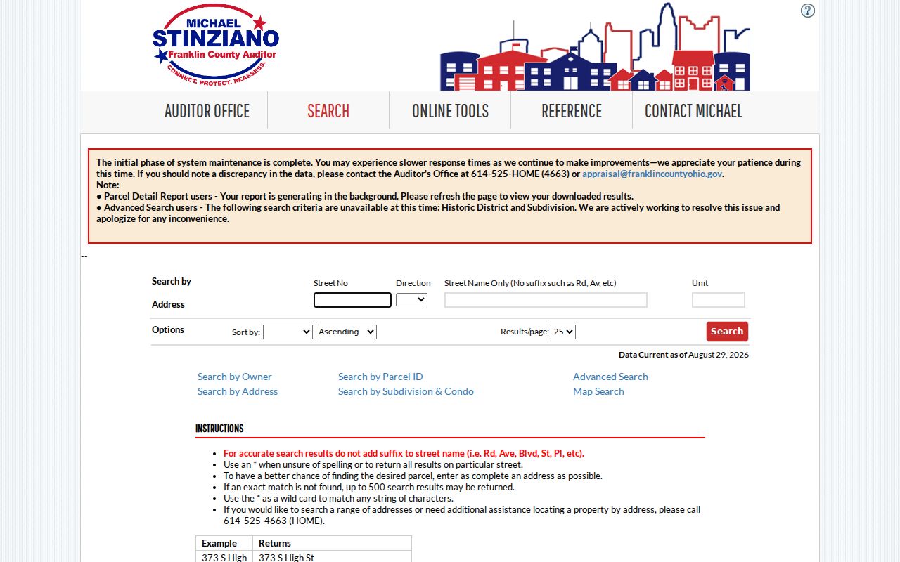
The separate direction and street-name controls make the suffix-free search method visible, while a parcel result still needs inspection before it is used as evidence.
Read a Grove City Parcel Card Carefully
A parcel card has several address-like fields, and they mean different things. The Franklin County Auditor separates the owner, the owner mailing/contact address, and the site or property address. Its inspected Grove City sample also showed the legal description, parcel ID, tax district, city or village, township, appraisal neighborhood, transfer date, transfer price, instrument type, property class, land use, and ZIP. Those fields make a parcel card a strong property record, but not a resident roster.
In particular, a mailing/contact address may belong to a post-office box, lender, attorney, company, or a different property. It can be useful for property correspondence. It does not prove that the contact lives at the situs. Likewise, an owner field misses anyone who has no ownership interest. A careful Grove City street directory labels these distinctions rather than treating a tax-record contact as the person at the door.
- Parcel
- The Auditor’s individual property identifier, used to connect a mapped property, tax record, and related land records.
- Situs address
- The physical location of the property, which can differ from the owner’s mailing/contact address.
- Legal description
- The lot, block, subdivision, condominium, or survey identity recorded with land documents. It is often the safer bridge to an older deed.
- Plat
- A recorded map that lays out lots, blocks, or subdivisions and helps place a parcel in its recorded setting.
Note: Record the legal description before opening an older deed because a modern street string may not appear in the historical index.
Map a Grove City Street Segment
The Parcel Viewer turns the address result into geography. Use Identify with a point, line, or polygon to return a selected record and its link to fuller property details. By Shape allows a drawn area. By Value starts with a selected layer and field, including examples such as parcel ID, subdivision or condominium name, annexations, and special tax districts. Layer List checkboxes control what is visible, and gray layer labels mean the layer is unavailable at the current zoom.
The same map has a careful way to inspect a short street segment. First locate a parcel through By Value or By Shape. Then open By Spatial, enter a distance, select Apply Buffer, and choose parcels wholly within the distance or those with any portion within it. The returned parcel set can be exported as CSV through the results menu. That describes nearby properties, not a list of people nearby.
Open the Franklin County Parcel Viewer to use the documented map controls.
The viewer is useful for preserving a parcel’s map context before moving into a deed or permit search.
Grove City Street Records by Address
Address-keyed sources do not duplicate one another. The Auditor identifies the current parcel and owner of record. The map shows the parcel footprint and local layers. The Recorder documents recorded interests. Building and zoning files can supply an application, project, inspection, or zoning context when that particular record is retained and public. The voter system handles a named person’s registration and precinct result. Reading those records as separate evidence avoids overstating what any one source proves.
| Address record | Local custodian | Evidence returned | Access route |
|---|---|---|---|
| Parcel/property record | Franklin County Auditor | Parcel ID, owner, site and mailing fields, legal description, values, and transfers | Property Search, counter, or Auditor verification |
| Mapped parcel | Franklin County Auditor GIS | Parcel geometry, selected layers, and nearby mapped parcels | Public Parcel Viewer |
| Deed, mortgage, or plat | Franklin County Recorder | Parties, recording date, document data, and legal-description context | Official Records Search or Recorder counter |
| Voter record | Ohio Secretary of State / Franklin County Board of Elections | A specified voter’s permitted registration and precinct information | Official lookup or focused Board request |
| Permit, zoning, or code file | Grove City Building & Zoning | Project and application chronology where the file is available | Portal, counter, phone, or focused records request |
The parcel number and legal description are the strongest handoff between local systems. A street name helps find the property, but it is not the Recorder’s index key and it does not turn the voter tool into a street directory. When a specific existing City or County file is not online, Ohio’s Public Records Act, ORC 149.43 permits a focused request for an identifiable, nonexempt record. The custodian need not create a new address list.
Bridge a Grove City Address to Deeds
The Recorder’s current Official Records Search does not provide a street-address field. Its Quick Search takes a term for grantor, grantee, subdivision, document type, or document number; it also has a recorded-date range and a choice between index-only and index-plus-OCR full-text searching. That design is why the parcel’s legal description, subdivision, current owner, and transfer date should be collected first.
Start with the latest conveyance shown on the Auditor card. Search the buyer or current owner and date, then preserve the grantor, grantee, recording number, date, and legal description. Search the seller as a grantee to locate an earlier acquisition. Repeat only when the description continues to identify the same parcel. A recorded deed traces a transfer or land interest, not every person who lived there. For an older household, pair the dated instrument with a directory or census source rather than filling gaps by assumption.
This indexing asymmetry is a local research rule: address to parcel, parcel to legal description, then legal description or party name to the Recorder. It keeps a Grove City street directory from failing when a recorded instrument omits a modern address.
Grove City Permit Files Use Two Systems
Permit and code records have a dated split. The legacy CityView Permit Search accepts an application number, address, parcel number, or permit-contact name and asks the user to choose a matching result. Grove City says applications submitted before September 1, 2026 remain in CityView for inspections and later activity. New code-enforcement complaints and zoning-permit applications move through GovWell, where the City describes account registration, submission, status tracking, and information access.
A blank result in the newer system therefore does not settle whether an earlier CityView file exists. Neither system should be treated as a resident list. A visible permit can provide a project or inspection trail, while a narrower request to Building & Zoning can seek an existing nonexempt file. The department is at 4035 Broadway and lists 614-277-3075 for contact.
Review the legacy CityView permit screen when an address may have pre-transition activity.
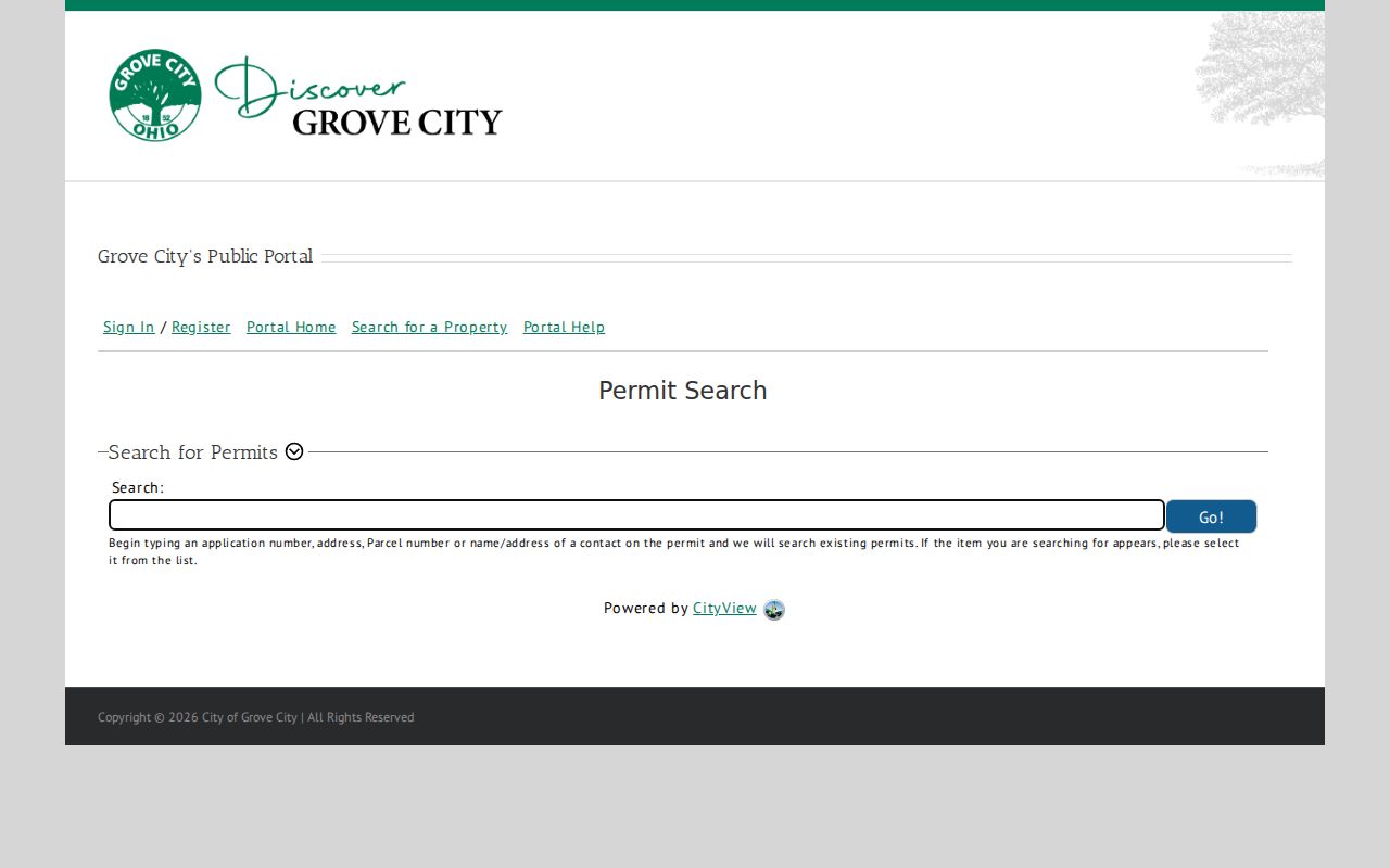
CityView’s address and parcel options show why a parcel number is worth retaining from the Auditor search.
Grove City Zoning Adds Place Context
The City zoning lookup is another address-context record, not a person lookup. Its map can return a zoning classification, ordinance, jurisdiction, passed and effective dates, former zoning, and a verified date. An unclassified result may mean the point is outside the City or is not a zoned property. That makes zoning useful for recognizing the governing area around a street result, especially where municipal boundaries or newer development complicate a postal label.
Use the Grove City zoning lookup after identifying the parcel, then compare its jurisdiction with the Auditor card. It is a place check, not a substitute for a deed, parcel, or voter record.
The City’s current GovWell portal is the documented route for new zoning-permit activity.
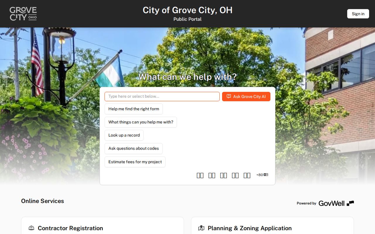
The current portal supports the City’s new application workflow, while the zoning map explains the jurisdictional setting of a chosen address.
Note: A zoning result identifies land-use context and jurisdiction, so it should never be described as evidence of occupancy.
Grove City Postal Labels Need a Parcel Check
A Grove City mailing label, including 43123, does not by itself establish City jurisdiction. City forms say Grove City parcel numbers begin with 040, while unincorporated Jackson Township parcels begin with 160. The City directs users to check the Auditor taxing district. For building work, township residential projects go to Franklin County Building, while township commercial work generally goes through Grove City except plumbing. That division matters when a street result has no expected municipal permit file.
The 1852 original plat and the Town Center grid add a second reason to preserve the legal description. Older village-core research may need lot, block, plat, and map context rather than a current address string alone. The research did not verify a citywide renumbering or a specific citywide street-name change. If an old number appears different, compare the deed description and plat or ask the Recorder or local-history staff instead of declaring that the address changed.
Grove City Voter Limits by Street
Ohio My Voter Information requires first name, last name, and county, with Franklin selected for the usual Grove City record route. After the search context, a street-name narrowing control may appear. The tool’s purpose is voter-registration and precinct or polling-place information. Its own guidance recommends trying a nickname or formal name, a former surname, or a prior Ohio county before treating a missing match as final. The Franklin County Board of Elections is the human route for a permitted question the web form cannot resolve.
Public voter information has statutory exclusions. Safe at Home participants are removed from the public-facing database, and protected fields remain unavailable. A registration result can help confirm a specified person against independent records. It cannot prove that every person at an address is a voter, nor can it support a block-by-block household roster. For a limited inspection or records-maintenance question, the Board is the appropriate custodian.
Limits of a Grove City Street Directory
Street and parcel tools show property data, not a complete household census. The Auditor does not show every occupant. The Parcel Viewer maps land rather than relationships. Recorder records show transactions and interests, not a current household. The voter source is an individual confirmation tool subject to statutory exclusions. Utility customer records, delivery information, and protected address programs do not become public substitutes when the ordinary records trail stops.
For a current property question, verify a significant result with the office that maintains it. For a historical question, use a dated directory, census, obituary, probate file, or local-history item only for the time that source covers. The point of this Grove City street directory is to distinguish those records, not to combine them into an unsupported claim about a living person.
Lawful use. Use Grove City address records for personal, family-history, property, or civic research. Do not use any result to stalk, harass, intimidate, or harm another person.